


Voting District 0005, Hopkins County, Texas
About
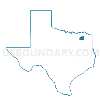
Outline

Summary
| Unique Area Identifier | 674841 |
| Name | Voting District 0005 |
| County | Hopkins County |
| State | Texas |
| Area (square miles) | 55.28 |
| Land Area (square miles) | 54.50 |
| Water Area (square miles) | 0.79 |
| % of Land Area | 98.58 |
| % of Water Area | 1.42 |
| Latitude of the Internal Point | 33.17320540 |
| Longtitude of the Internal Point | -95.34861480 |
Maps


Graphs
Select a template below for downloading or customizing gragh for Voting District 0005, Hopkins County, Texas


Neighbors
Neighoring Voting District (by Name) Neighboring Voting District on the Map
- Voting District 0012, Hopkins County, TX
- Voting District 0013, Hopkins County, TX
- Voting District 0014, Hopkins County, TX
- Voting District 0023, Hopkins County, TX
- Voting District 0024, Hopkins County, TX
- Voting District 0101, Franklin County, TX
- Voting District 0102, Franklin County, TX
- Voting District 0301, Franklin County, TX
Top 10 Neighboring County Subdivision (by Population) Neighboring County Subdivision on the Map
- Mount Vernon CCD, Franklin County, TX (8,148)
- Pickton-Pine Forest CCD, Hopkins County, TX (4,915)
- North Hopkins-Sulphur Bluff CCD, Hopkins County, TX (2,825)
Top 10 Neighboring Unified School District (by Population) Neighboring Unified School District on the Map
- Mount Vernon Independent School District, TX (9,127)
- Como-Pickton Consolidated Independent School District, TX (3,791)
- Saltillo Independent School District, TX (1,193)
- Sulphur Bluff Independent School District, TX (1,164)
Top 10 Neighboring State Legislative District Lower Chamber (by Population) Neighboring State Legislative District Lower Chamber on the Map
Top 10 Neighboring State Legislative District Upper Chamber (by Population) Neighboring State Legislative District Upper Chamber on the Map
Top 10 Neighboring 111th Congressional District (by Population) Neighboring 111th Congressional District on the Map
Top 10 Neighboring Census Tract (by Population) Neighboring Census Tract on the Map
- Census Tract 9501, Franklin County, TX (5,385)
- Census Tract 9507, Hopkins County, TX (4,915)
- Census Tract 9501, Hopkins County, TX (2,825)
Top 10 Neighboring 5-Digit ZIP Code Tabulation Area (by Population) Neighboring 5-Digit ZIP Code Tabulation Area on the Map
- 75494, TX (10,862)
- 75457, TX (6,522)
- 75487, TX (1,541)
- 75471, TX (1,424)
- 75437, TX (1,078)
- 75478, TX (932)
- 75481, TX (395)